Georgian
1714 – 1837 and the most accurate map we have so far of the village with the Chapman and Andre map of 1777 being created. Another map which would have brought a lot of change for people is the 1808 Enclosure Map when all the land around Chrishall was re-allocated and a lot of the common grazing rights were lost.
Local landowners did try to look after their workers, coming up with schemes to employ men in the leanest months of the year, such as Chalky Lane re-surfacing scheme.
However the period ends with reports of poaching and very little work for the men and women of the village. Could these things be linked…?
Some articles for this period
-

A period of unrest leads to road improvements!
1830 Wheat 64s 3d per quarter. A changeable summer. Accounts of the harvest vary, some recording a good harvest and some estimating it as less than average. Blizzards in mid-January and severe frosts in February, March was fine, warm and excellent for sowing. July was very hot, but August and September were wet. Sheep-rot very…
-

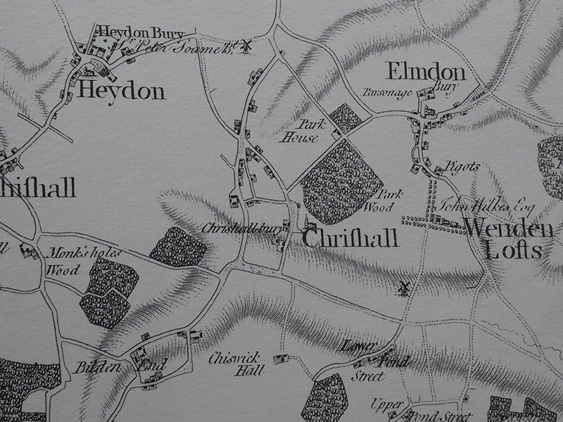
Chapman and Andre 1777
Time for a game – spot the difference. Above you can see an extract from the Chapman and Andre map of 1777 (reproduced with permission from Essex Record Office). The Chapman and Andre maps of this date are reputed to be the most accurate maps of the time, but I can see one large part of…
-
Grazing on Chrishall Common
Before the Enclosure Acts, Chrishall Common was the land at the back of the High Street heading over towards Chishill. Exactly where it was I don’t know but you do see it marked on old maps …