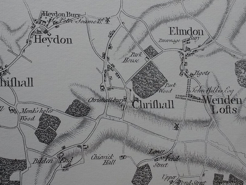
Time for a game – spot the difference. Above you can see an extract from the Chapman and Andre map of 1777 (reproduced with permission from Essex Record Office). The Chapman and Andre maps of this date are reputed to be the most accurate maps of the time, but I can see one large part of the village that is missing from this map. Can you?
It is of course Broad Green which doesn’t appear on this map at all. I am fairly certain Broad Green farm (or Gents Farm) would have been there by this stage, but maybe there was just a track to the farm an no solid road – although I suspect none of the village roads were much more than tracks at this time.
This map is fascinating for a whole host of reasons though. You can see both windmills – Chrishall and the one near Pond Street. You can also see the old manor of Chrishall Bury marked just down from the church. And the position of old Park House in the corner of Park Wood and Dark Lane. Notice too how Park Wood and Dark Lane are marked as village roads at this time.
There is a new version of this map available online now at https://map-of-essex.uk/.


0 Comments